From the heights of Archipenque viewpoint, the town appears to occupy only a small corner of the coast. Beyond the harbour, a dark wall extends towards Teno and disappears behind successive headlands. This is one of Tenerife's best-known scenes, although it says little about the experience of looking up at the same cliffs from below. At sea level, your gaze can no longer encompass the coastline and the top of the cliffs at the same time.
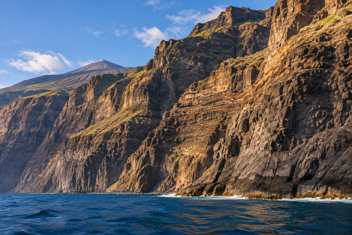
Los Gigantes consists of volcanic cliffs reaching hundreds of metres in height. The wall belongs to the ancient Teno massif, whose ravines and slopes continue inland. It is not essential to go out on the water to appreciate it, and nor should you assume that the best possible view can always be obtained from one particular type of vessel.
Looking down on the town from Archipenque
Archipenque viewpoint helps you understand the setting of Los Gigantes. From here you can distinguish the buildings of the town, the harbour and the direction in which the cliffs extend. The contrast between the houses and the rock wall provides a useful initial reference for its scale.
The elevated position also helps you identify the harbour as an area of maritime activity, with vessels arriving, leaving and manoeuvring. The distribution of different uses along the shore is not so apparent when viewed from a street in the town or from a kayak sitting low on the water.
On clear days, the views may include the island of La Gomera, situated across the channel. Atmospheric dust or moisture can obscure the horizon. This does not detract from the interest of the viewpoint: nearby layers of rock take on different shades as the light changes.
For panoramic photography, a relatively wide lens allows you to show the continuity between the wall and the inhabited part of the coast. A picture that concentrates exclusively on the rock leaves out familiar human-sized features and makes its dimensions more difficult to estimate.
The harbour, streets and beach
The streets of the town descend towards the water. Walking from accommodation located higher up may involve a short horizontal distance but a considerably more strenuous return. Bear this in mind, especially when carrying swimming equipment or a backpack.
The beach of Los Guíos is situated near the harbour and offers a low-level view of part of the cliff. Available space depends on sea state and access conditions. Follow local notices when visiting, since waves and rockfalls are among the hazards of this rugged landscape.
Boats provide a reliable way of illustrating the scale of the wall in photographs. Instead of approaching less accessible stretches of shoreline, observe how the apparent size of boats changes as they travel away. The height of the cliff is also evident in the distance separating a boat from the upper outline of the rock.
Related reading: Masca at a slower pace: the village, the gorge and the mountains around it.
A walk around the public spaces of the seafront can be extended to Puerto de Santiago and other points along the nearby coast. From each sector you can see a different part of the formation, making it easier to distinguish inlets, headlands and the ravines that reach the sea.
Rock upon rock: the origins of the wall
Los Gigantes is not the edge of a single massive lava flow. As Teno formed, the products of numerous volcanic episodes accumulated. The passage of time and erosion exposed part of this accumulation, which you can now recognise in the bands of different materials on the face of the cliff.
Some materials form compact surfaces. Between them lie layers of fragments and sections that undergo erosion in different ways. The dark lines cutting across other rock formations may be old volcanic intrusions known as dykes.
The action of the waves continues at the base, while water and gravity work on the cracks higher up. The cliffs are not a motionless structure designed for people to explore: rockfalls form part of the evolution of this landscape.
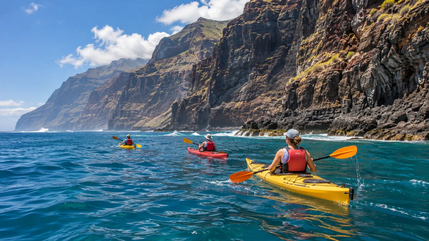
This is one reason why an appealing photograph of the cliffs does not have to be taken right at their base. A sideways view from some distance allows you to distinguish layers, the cuts separating one ravine from another and the outline of the upper ridges.
The perspective from a vessel
An authorised maritime excursion allows you to appreciate the continuation of the cliffs towards the north and recognise areas not visible from the town. Depending on the route and conditions, you can gain a more complete understanding of the coastal profile and the ravines.
A boat offers an observation point that is somewhat elevated above the surface of the sea. This makes it easier to look upwards without losing sight of your immediate surroundings. A kayak, in contrast, puts you directly at water level and makes the movement of the waves much more apparent.
In a kayak, planning an excursion cannot be based purely on how close you want to get to the rock walls. Sea state, wind, distance to safe exit points and coastal exposure are crucial factors. Some areas have no accessible places to land. Consider a guided activity appropriate to the abilities of the participants.
In a stretch of water used by boat traffic, navigation restrictions also matter. A paddler seated in a kayak has a low profile and must not assume that a large vessel will detect them from a distance. The directions of a local professional and the rules applicable to the area are essential.
A living marine environment
The west coast of Tenerife borders deep water inhabited by a range of species. Closer to the shore, rocky areas of seabed provide habitat and food for numerous organisms. The structure of the underwater landscape affects which fish you can see and where different types of algae appear.
The channel between Tenerife and La Gomera is known for the presence of cetaceans, including pilot whales and dolphins. Observation of these animals must comply with the specific protective rules. Seeing one does not entitle you to pursue it, cross its path or remain unduly close.
On any maritime outing, avoid throwing waste or food into the water, and do not attempt to touch animals. From a small craft an encounter may feel more intimate, but the needs of the animal and the legal limits do not change because of the type of vessel being used.
How the cliffs change throughout the day
Even when you visit the same viewpoint twice, the wall may look completely different. At certain times, large areas remain in shade, and the shape of the relief stands out. Under light arriving from the side, reddish and ochre tones emerge among the dark surfaces.
For anyone staying in the west, dividing the visit between a morning on land and a maritime outing on a different day allows a comparison of the two perspectives. It also leaves room to adapt plans when sailing conditions change.
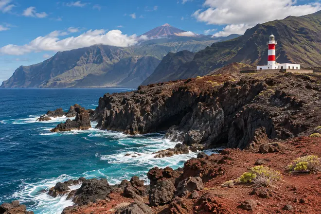
Los Gigantes can be the beginning of a wider exploration of the old Teno massif. Punta de Teno shows the end of the great cliff wall; Masca introduces its inland ravines; El Palmar shows the cultivated side of the mountains. Each place adds a different part of a geological story extending well beyond the familiar view from the harbour.
Explore next: Kayaking in Los Gigantes.